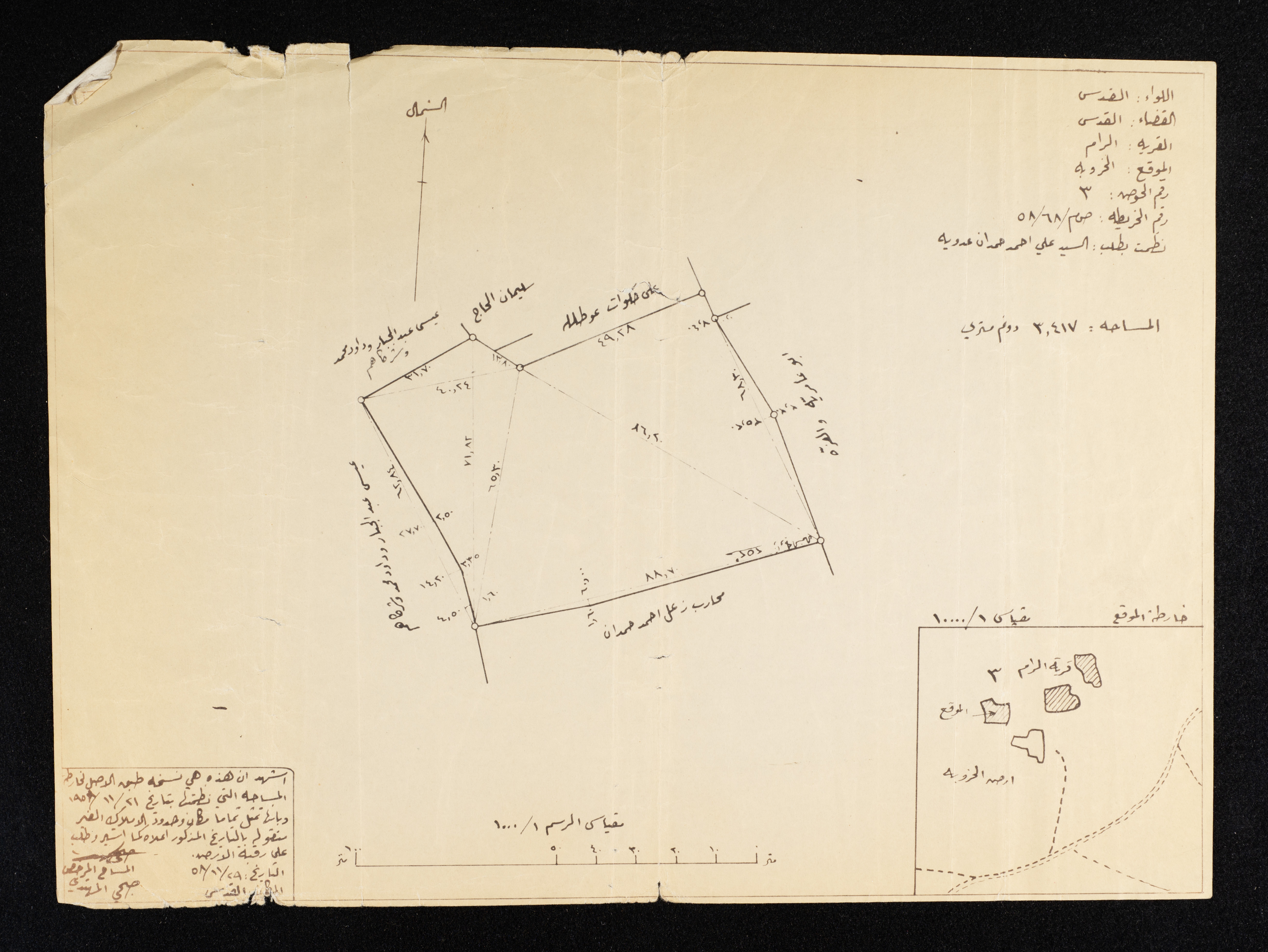
Plan of a Plot of Land in the Village of al-Ram, Belonging to the Jerusalem District, 29 November 1958
Dated 29 November 1958, a location plan by Ali Ahmad Hamdan Adawiya for a plot of land in the village of al-Ram in the Jerusalem District, Basin No. 3, and map No. AM/68/85, with an area of 3 dunums and 417 meters. The licensed surveyor “Subhi al-Muhtadi” wrote in the lower left that this is a replica. The original survey map was organized on 21 November 1958, and it fully represents the location and boundaries of the immovable property on the date mentioned above.
Date created
Tags
Topics
TYPE
LOCATION
More details
Format
Records (Documents)
Source of Description
Ibreigeth, Razan. "The Anwar Nusseibeh Collection". Archival Inventory. June 2021. The Palestinian Museum Digital Archive.
Help us refine the information, suggest a change in the content of this item
Suggest a ChangePlan of a Plot of Land in the Village of al-Ram, Belonging to the Jerusalem District, 29 November 1958
This photo may contain violent content